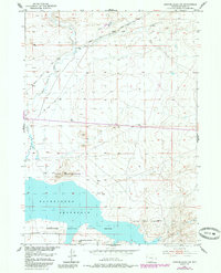
1951 Map of Benton Basin SW
USGS Topo · Published 1985About this map
The historical Oregon Trail cuts through this high-plains landscape, marking the legacy of westward migration across Natrona County. In the northern reaches of this map, the trail runs parallel to the Pipe Line Road and crosses Pino Draw, illustrating the intersection of pioneer history and mid-century utility infrastructure. Water is the primary shaper of human activity here, with Horse Creek and Fish Creek draining toward the southern portion of the quadrangle. This area is dominated by the massive Pathfinder Reservoir, a critical water resource for the region. Much of the shoreline and surrounding basin is preserved within the Pathfinder National Wildlife Refuge, where the Wildlife Refuge Boundary delineates protected habitat. Low-impact industrial and agricultural marks are sparse, noted only by an occasional Oil Tank and Windmill, reflecting a landscape dedicated to water storage and conservation.
Find a feature on this map
12 named features on this map. Tap any name to fly to it.
Don’t see what you’re looking for? This feature index may not catch every label — zoom into the map to look around manually.
Map Details
Editions of this 1951 Benton Basin SW Map
3 editions found
Other maps of this area

1951 · Benton Basin SW
USGS Topo · 1:24,000

1951 · Benton Basin
USGS Topo · 1:24,000

1951 · Pathfinder Reservoir NW
USGS Topo · 1:24,000

1951 · Benton Basin NE
USGS Topo · 1:24,000

1951 · Mc Cleary Reservoir
USGS Topo · 1:24,000

1951 · Pathfinder Dam
USGS Topo · 1:24,000

1951 · Fort Ridge
USGS Topo · 1:24,000

1955 · Casper
USGS Topo · 1:250,000

1958 · Casper
USGS Topo · 1:250,000

1959 · Horse Creek Springs
USGS Topo · 1:24,000