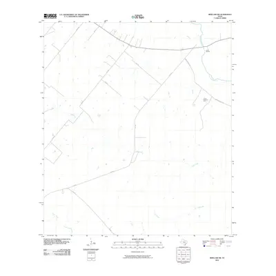
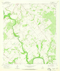
2010 Map of Berclair NW
USGS Topo · Published 2010About this map
The San Antonio River defines the northeastern boundary of this Bee County landscape, where the riparian corridor meets the ranchlands of South Texas. Local history is anchored by the Charco Cemetery, situated near the riverbanks, serving as a significant landmark for genealogists and researchers of the area’s early residents. The terrain is a network of seasonal drainages, including the branching paths of Hord Creek and Lost Creek, which cut through the open country. Energy extraction is a visible part of the local economy, represented here by the Hordes Creek Gas Field. A grid of rural routes and farm-to-market roads, such as Mail Rd and Newton-Powell Rd, connects the scattered properties and agricultural operations like the Lazy F Ranch.
Find a feature on this map
15 named features on this map. Tap any name to fly to it.
Don’t see what you’re looking for? This feature index may not catch every label — zoom into the map to look around manually.
Map Details
Editions of this 2010 Berclair NW Map
This is the sole edition of this map. No revisions or reprints were ever made.
Other maps of this area

1936 · Pettus
USGS Topo · 1:62,500

1953 · Beeville
USGS Topo · 1:250,000

1956 · Beeville
USGS Topo · 1:250,000

1956 · Pettus
USGS Topo · 1:62,500

1956 · Karnes City
USGS Topo · 1:62,500

1960 · Beeville
USGS Topo · 1:250,000
1961 · Kenedy
USGS Topo · 1:24,000
1963 · Tuleta
USGS Topo · 1:24,000
1963 · Tulsita
USGS Topo · 1:24,000
1963 · Choate
USGS Topo · 1:24,000