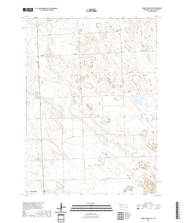
2021 Map of Berea Creek East
USGS Topo · Published 2021About this map
Box Butte stands as a primary landmark in this section of the High Plains, where the drainage systems of Box Butte Creek and Hemingford Cr define the subtle topography of the Nebraska panhandle. The area is organized by a precise grid of county roads including Hayes Rd, Jefferson Rd, and Lincoln Rd, which facilitate access to the agricultural parcels surrounding the northern edge of Alliance. For those researching local heritage, the map identifies significant burial sites such as Fairview Cem in the north and Calvary Cem near the southern boundary. This landscape shows the enduring patterns of rural land division and water management, with the intermittent flows of the N Fork Berea Cr and Berea Cr carving narrow paths through the open terrain.
Find a feature on this map
26 named features on this map. Tap any name to fly to it.
Don’t see what you’re looking for? This feature index may not catch every label — zoom into the map to look around manually.
Map Details
Editions of this 2021 Berea Creek East Map
This is the sole edition of this map. No revisions or reprints were ever made.
Other maps of this area

1946 · Berea Creek East
USGS Topo · 1:24,000

1947 · Alliance
USGS Topo · 1:24,000

1947 · Bronco Lake
USGS Topo · 1:24,000

1947 · Box Butte
USGS Topo · 1:24,000

1948 · Berea Creek West
USGS Topo · 1:24,000

1948 · Berea Creek East
USGS Topo · 1:24,000

1948 · Alliance
USGS Topo · 1:24,000

1948 · Antioch
USGS Topo · 1:62,500

1949 · Box Butte SW
USGS Topo · 1:24,000
1949 · Bronco Lake
USGS Topo · 1:24,000