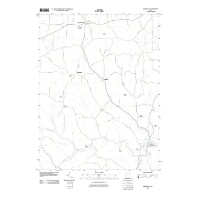
2010 Map of Bergholz
USGS Topo · Published 2010About this map
Mechanicstown and Bergholz anchor this section of Jefferson County, where the dendritic drainage of the Upper North Fork and its tributaries like Frog Run and Carroll Run has carved a landscape of high ridges and deep hollows. The settlement pattern is defined by small, long-established communities and a remarkable concentration of family and community graveyards, including the Snyder Cemetery, Corinth-Mechanicstown Cemetery, and Palmer Cemetery. These sites, alongside landmarks like the Mechanicstown Post Office, trace the lineage of early area residents across the upland terrain.
Find a feature on this map
72 named features on this map. Tap any name to fly to it.
Don’t see what you’re looking for? This feature index may not catch every label — zoom into the map to look around manually.
Map Details
Editions of this 2010 Bergholz Map
This is the sole edition of this map. No revisions or reprints were ever made.
Other maps of this area

1901 · Cadiz
USGS Topo · 1:62,500

1902 · Scio
USGS Topo · 1:62,500

1903 · Cadiz
USGS Topo · 1:62,500

1904 · Scio
USGS Topo · 1:62,500

1905 · Salineville
USGS Topo · 1:62,500

1910 · Carrollton
USGS Topo · 1:62,500

1912 · Carrollton
USGS Topo · 1:62,500

1951 · Canton
USGS Topo · 1:250,000

1953 · Canton
USGS Topo · 1:250,000

1957 · Canton
USGS Topo · 1:250,000