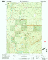
1999 Map of Bergland NE
USGS Topo · Published 2004About this map
Industrial infrastructure and protected wilderness converge in this detailed mapping of the Ottawa National Forest near the turn of the 21st century. The map centers on the northern reach of the Trap Hills, where the National Scenic Trail winds through high ground overlooking the Big Iron River and its numerous tributaries. To the north, the presence of the White Pine Mine and the adjacent settlement of White Pine signals the area's copper mining legacy, supported by the Anderson Pipeline and Mineral Pipeline networks that traverse the landscape.
Find a feature on this map
43 named features on this map. Tap any name to fly to it.
Don’t see what you’re looking for? This feature index may not catch every label — zoom into the map to look around manually.
Map Details
Editions of this 1999 Bergland NE Map
This is the sole edition of this map. No revisions or reprints were ever made.
Other maps of this area

1949 · Matchwood NW
USGS Topo · 1:24,000

1949 · White Pine
USGS Topo · 1:24,000

1949 · Bergland NE
USGS Topo · 1:24,000

1955 · Ontonagon
USGS Topo · 1:62,500

1956 · Bergland NE
USGS Topo · 1:24,000

1956 · Bergland
USGS Topo · 1:62,500

1956 · White Pine
USGS Topo · 1:24,000

1956 · Matchwood NW
USGS Topo · 1:24,000

1956 · White Pine
USGS Topo · 1:62,500

1956 · Matchwood
USGS Topo · 1:62,500