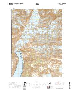
2017 Map of Bering Glacier A-1 NE
USGS Topo · Published 2017About this map
Wrangell-Saint Elias National Park encompasses this coastal alpine landscape where the Saint Elias Mountains meet the sea. The geography is defined by significant ice movement and glacial recession, particularly around Tyndall Glacier and the Agassiz Glacier. These frozen masses feed into the Gulf of Alaska and the evolving Agassiz Lakes, illustrating the dynamic nature of the Yakutat coastline in the early twenty-first century. High-elevation terrain like Hoof Hill rises above the glacial flow, marking points of stable ground in an environment otherwise dominated by shifting ice and water. This survey offers a precise look at the drainage patterns and shoreline morphology of this protected wilderness during a period of documented environmental change.
Find a feature on this map
13 named features on this map. Tap any name to fly to it.
Don’t see what you’re looking for? This feature index may not catch every label — zoom into the map to look around manually.
Map Details
Editions of this 2017 Bering Glacier A-1 NE Map
This is the sole edition of this map. No revisions or reprints were ever made.
Other maps of this area

1950 · Bering Glacier
USGS Topo · 1:250,000

1951 · Bering Glacier
USGS Topo · 1:250,000

1951 · Mt Saint Elias
USGS Topo · 1:250,000

1959 · Bering Glacier
USGS Topo · 1:250,000

1959 · Mt Saint Elias
USGS Topo · 1:250,000
1985 · Bering Glacier B-1
USGS Topo · 1:63,360
1985 · Mount Saint Elias A-8
USGS Topo · 1:63,360
1985 · Mount Saint Elias B-8
USGS Topo · 1:63,360
1985 · Bering Glacier A-1
USGS Topo · 1:63,360
2017 · Bering Glacier A-1 SE
USGS Topo · 1:25,000