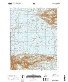
2017 Map of Bering Glacier B-3 SE
USGS Topo · Published 2017About this map
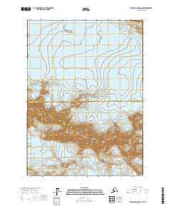
Wrangell-Saint Elias National Park dominates this high-latitude terrain, preserving a landscape of immense moving ice and sharp elevation changes. The southern portion of the map is defined by the Robinson Mountains, where steep contours indicate the dramatic rise of coastal peaks above the glacial plains. Two major ice flows, the Yahtse Glacier and Guyot Glacier, bracket the mountain range, illustrating the massive scale of the Saint Elias mountain system. This survey emphasizes the physical geography of a remote wilderness area where human infrastructure is entirely absent, replaced instead by the dynamic interactions of the Public Land Survey System grids, such as t19s r21e, across the ice fields.
Find a feature on this map
8 named features on this map. Tap any name to fly to it.
Don’t see what you’re looking for? This feature index may not catch every label — zoom into the map to look around manually.
Map Details
Editions of this 2017 Bering Glacier B-3 SE Map
This is the sole edition of this map. No revisions or reprints were ever made.
Other maps of this area

1950 · Bering Glacier A-3
USGS Topo · 1:63,360

1950 · Bering Glacier
USGS Topo · 1:250,000

1951 · Bering Glacier
USGS Topo · 1:250,000

1951 · Bering Glacier A-2
USGS Topo · 1:63,360

1959 · Bering Glacier
USGS Topo · 1:250,000
1959 · Bering Glacier A-3
USGS Topo · 1:63,360

1959 · Bering Glacier A-2
USGS Topo · 1:63,360
1985 · Bering Glacier B-3
USGS Topo · 1:63,360
1985 · Bering Glacier B-2
USGS Topo · 1:63,360
2017 · Bering Glacier B-2 NW
USGS Topo · 1:25,000