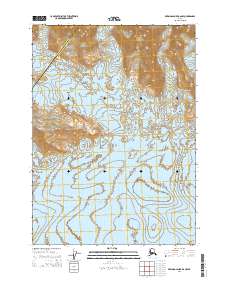
2014 Map of Bering Glacier B-6 NW
USGS Topo · Published 2014About this map
Glacial dynamics and high-altitude relief define this section of the Alsek River region where the Chugach Mountains meet massive ice flows. The terrain is dominated by the sprawling reaches of the Waxell Glacier and the Bering Glacier, which together shape a landscape of complex ice movement and terminal deposition. One of the most distinctive markers of this activity is the Central Medial Moraine Band, a geological signature of converging ice streams carrying rocky debris through the glacier's center. This area marks a significant administrative boundary, where the Valdez-Cordova Census Area meets the Yakutat City and Borough. The map's detailed contouring reveals the massive scale of the mountain peaks contrasted with the broad, slow-moving ice fields that continue to reshape the southern Alaskan coast.
Find a feature on this map
11 named features on this map. Tap any name to fly to it.
Don’t see what you’re looking for? This feature index may not catch every label — zoom into the map to look around manually.
Map Details
Editions of this 2014 Bering Glacier B-6 NW Map
This is the sole edition of this map. No revisions or reprints were ever made.
Other maps of this area

1950 · Bering Glacier
USGS Topo · 1:250,000

1951 · Bering Glacier
USGS Topo · 1:250,000

1959 · Bering Glacier
USGS Topo · 1:250,000
1985 · Bering Glacier C-7
USGS Topo · 1:63,360
1985 · Bering Glacier B-6
USGS Topo · 1:63,360
1985 · Bering Glacier B-7
USGS Topo · 1:63,360
1985 · Bering Glacier C-6
USGS Topo · 1:63,360
2014 · Bering Glacier C-6 SW
USGS Topo · 1:25,000
2014 · Bering Glacier B-7 NE
USGS Topo · 1:25,000
2014 · Bering Glacier C-7 SE
USGS Topo · 1:25,000