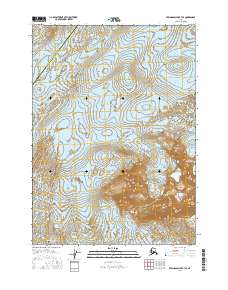
2016 Map of Bering Glacier B-7 SE
USGS Topo · Published 2016About this map
The vast icy expanse of the Bering Glacier dominates this landscape along the Gulf of Alaska coast, revealing a dynamic environment of shifting ice and glacial meltwater. The southeastern portion of this survey is defined by the Grindle Hills, a series of elevated landforms that stand as prominent landmarks against the massive ice sheet. The map also delineates the administrative boundary between the Valdez-Cordova Census Area and Yakutat City and Borough. This area represents a remote stretch of the Alaska coastline where topography is constantly reshaped by glacial activity. The detailed contour intervals and hydrography provide a precise record of the ice-margin positions and the intricate drainage patterns developing at the edge of the glacier's massive footprint in the early 21st century.
Find a feature on this map
13 named features on this map. Tap any name to fly to it.
Don’t see what you’re looking for? This feature index may not catch every label — zoom into the map to look around manually.
Map Details
Editions of this 2016 Bering Glacier B-7 SE Map
This is the sole edition of this map. No revisions or reprints were ever made.
Other maps of this area

1950 · Bering Glacier
USGS Topo · 1:250,000

1951 · Bering Glacier
USGS Topo · 1:250,000

1959 · Bering Glacier
USGS Topo · 1:250,000
1984 · Bering Glacier A-6
USGS Topo · 1:63,360
1984 · Bering Glacier A-7
USGS Topo · 1:63,360
1985 · Bering Glacier B-6
USGS Topo · 1:63,360
1985 · Bering Glacier B-7
USGS Topo · 1:63,360
2014 · Bering Glacier B-7 NW
USGS Topo · 1:25,000
2014 · Bering Glacier B-7 NE
USGS Topo · 1:25,000
2014 · Bering Glacier B-6 NW
USGS Topo · 1:25,000