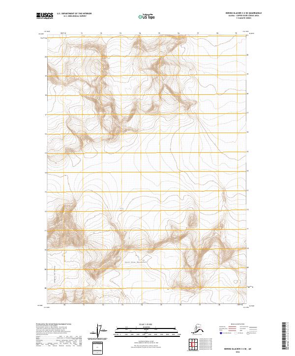
2024 Map of Bering Glacier C-2 SE
USGS Topo · Published 2024About this map
Saint Elias Mountains dominate the landscape of this region, which is preserved as part of the Wrangell-St. Elias Wilderness. The terrain is defined by massive glacial systems and high-altitude ice fields, most notably the Bagley Ice Valley which cuts through the southwestern corner of the sheet. At the center of the survey lies a significant portion of the Bering Glacier, illustrating the immense scale of subarctic ice movement. The topography here is entirely non-residential, characterized by extreme elevations and deep glacial basins rather than human settlements or roads. This document serves as a high-resolution record of the glacier's extent and the surrounding mountain faces in the mid-2020s, providing critical data for understanding the physical geography of this protected Alaskan wilderness.
Find a feature on this map
11 named features on this map. Tap any name to fly to it.
Don’t see what you’re looking for? This feature index may not catch every label — zoom into the map to look around manually.
Map Details
Editions of this 2024 Bering Glacier C-2 SE Map
This is the sole edition of this map. No revisions or reprints were ever made.
Other maps of this area

1950 · Bering Glacier
USGS Topo · 1:250,000

1951 · Bering Glacier
USGS Topo · 1:250,000

1959 · Bering Glacier
USGS Topo · 1:250,000
1985 · Bering Glacier B-1
USGS Topo · 1:63,360
1985 · Bering Glacier C-2
USGS Topo · 1:63,360
1985 · Bering Glacier C-1
USGS Topo · 1:63,360
1985 · Bering Glacier B-2
USGS Topo · 1:63,360
2017 · Bering Glacier B-2 NW
USGS Topo · 1:25,000
2017 · Bering Glacier C-2 NW
USGS Topo · 1:25,000
2017 · Bering Glacier C-1 SW
USGS Topo · 1:25,000