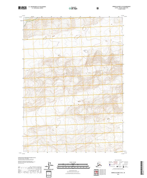
2024 Map of Bering Glacier C-8 SE
USGS Topo · Published 2024About this map
Chugach National Forest encompasses the northwestern reaches of this topographic study, where the landscape is defined by extreme glacial activity and high-elevation relief. The massive Martin River Glacier dominates the central-eastern portion of the sheet, illustrating the massive ice flows that shape this part of Alaska. To the south, the Plenisner Hills emerge as a distinct topographic cluster, providing a contrast to the surrounding ice-scoured terrain. The map is primarily characterized by these natural features and the rigorous Public Land Survey System grid lines of t14s r9e, t15s r10e, and their neighboring townships, which underscore the effort to organize and document this uninhabited wilderness during the early 21st century.
Find a feature on this map
9 named features on this map. Tap any name to fly to it.
Don’t see what you’re looking for? This feature index may not catch every label — zoom into the map to look around manually.
Map Details
Editions of this 2024 Bering Glacier C-8 SE Map
This is the sole edition of this map. No revisions or reprints were ever made.
Other maps of this area

1950 · Bering Glacier
USGS Topo · 1:250,000

1951 · Bering Glacier
USGS Topo · 1:250,000

1959 · Bering Glacier
USGS Topo · 1:250,000
1985 · Bering Glacier C-7
USGS Topo · 1:63,360
1985 · Bering Glacier B-8
USGS Topo · 1:63,360
1985 · Bering Glacier B-7
USGS Topo · 1:63,360
1985 · Bering Glacier C-8
USGS Topo · 1:63,360
2014 · Bering Glacier C-8 SE
USGS Topo · 1:25,000
2014 · Bering Glacier B-7 NW
USGS Topo · 1:25,000
2014 · Bering Glacier C-8 NW
USGS Topo · 1:25,000