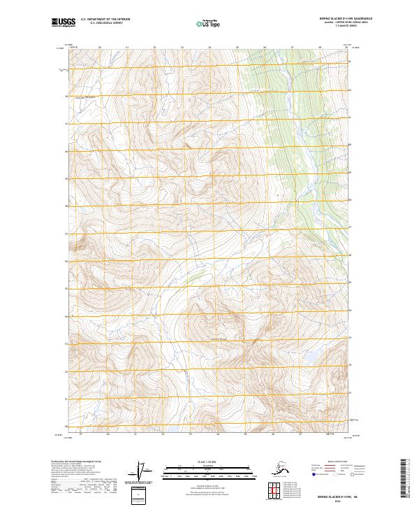
2024 Map of Bering Glacier D-4 NW
USGS Topo · Published 2024About this map
The Saint Elias Mountains dominate the northwestern horizon of this Alaskan quadrangle, part of a high-altitude wilderness defined by its massive glacial systems and steep vertical relief. Much of the land falls within the protected Wrangell-St. Elias Wilderness, a designation that preserves this untouched segment of the Copper River Census Area. The terrain is deeply incised by drainage networks, most notably the Kiagna River and its various tributaries. These waterways, including Bearhole Creek and Martin Creek, carve through the complex topography of the Granite Range. The map reflects a landscape where natural physical barriers dictate the flow of water and the absence of permanent human infrastructure, offering a pristine look at the region as it remains in the early twenty-first century.
Find a feature on this map
10 named features on this map. Tap any name to fly to it.
Don’t see what you’re looking for? This feature index may not catch every label — zoom into the map to look around manually.
Map Details
Editions of this 2024 Bering Glacier D-4 NW Map
This is the sole edition of this map. No revisions or reprints were ever made.
Other maps of this area

1950 · Bering Glacier
USGS Topo · 1:250,000

1951 · McCarthy
USGS Topo · 1:250,000

1951 · Bering Glacier
USGS Topo · 1:250,000

1959 · McCarthy A-4
USGS Topo · 1:63,360

1959 · McCarthy A-5
USGS Topo · 1:63,360

1959 · Bering Glacier
USGS Topo · 1:250,000

1960 · McCarthy
USGS Topo · 1:250,000

1984 · Bering Glacier D-4
USGS Topo · 1:63,360

1984 · Bering Glacier D-5
USGS Topo · 1:63,360
1994 · McCarthy A-4
USGS Topo · 1:63,360