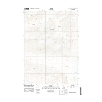
2014 Map of Bering Glacier D-7 NE
USGS Topo · Published 2014About this map
Wrangell-Saint Elias National Park protects this glaciated terrain, where massive ice fields and drainage systems define the geography. The southern reaches of the map are dominated by the Bremner Glacier, including its massive Middle Fork Lobe, which serves as the source for the N Fork Bremner River. To the north, the landscape is carved by several distinct watercourses, including Monahan Cr, Ptarmigan Cr, and Standard Cr. The eastern edge is marked by the Chokina River, highlighting the complex watershed patterns typical of this portion of the Unorganized Borough. This 2014 survey captures the precise positioning of these glacial features and wilderness waterways within the federal park boundaries.
Find a feature on this map
12 named features on this map. Tap any name to fly to it.
Don’t see what you’re looking for? This feature index may not catch every label — zoom into the map to look around manually.
Map Details
Editions of this 2014 Bering Glacier D-7 NE Map
This is the sole edition of this map. No revisions or reprints were ever made.
Other maps of this area

1950 · Bering Glacier
USGS Topo · 1:250,000

1951 · McCarthy
USGS Topo · 1:250,000

1951 · Bering Glacier
USGS Topo · 1:250,000

1959 · McCarthy A-6
USGS Topo · 1:63,360

1959 · Bering Glacier
USGS Topo · 1:250,000

1959 · McCarthy A-7
USGS Topo · 1:63,360

1960 · McCarthy
USGS Topo · 1:250,000
1984 · Bering Glacier D-7
USGS Topo · 1:63,360
1984 · Bering Glacier D-6
USGS Topo · 1:63,360

1994 · McCarthy A-6
USGS Topo · 1:63,360