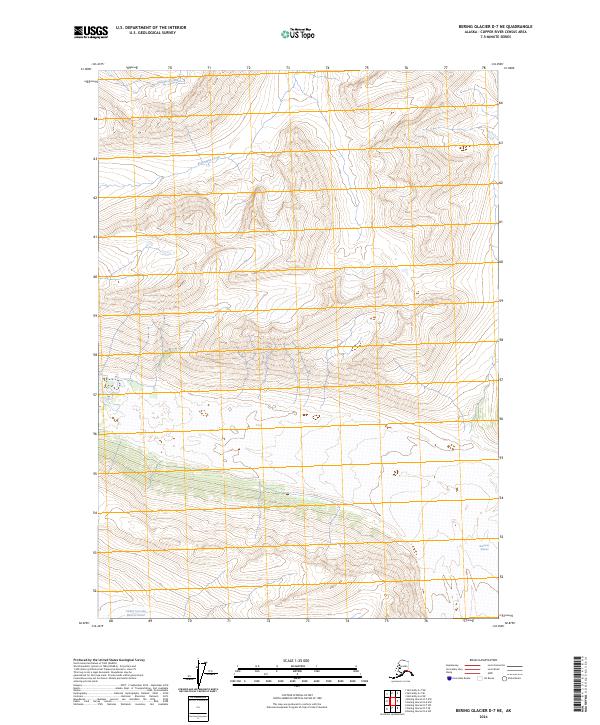
2024 Map of Bering Glacier D-7 NE
USGS Topo · Published 2024About this map
Wrangell-St. Elias Wilderness encompasses the majority of this Alaskan landscape, characterized by significant glacial formations and mountain watersheds. The southern reaches of the map are defined by the massive ice of the Bremner Glacier, including the distinct Middle Fork Lobe Bremner Glacier which dominates the drainage patterns of the lower quadrangle. In the northern sections, the terrain is carved by steep drainages including Ptarmigan Creek and Hanard Creek, which flow through the high-elevation backcountry. The survey provides a precise look at the township and range lines, such as t10s r11e and t11s r12e, within this protected wilderness area, showing the intersection of official land management boundaries and the natural flow of glacial ice and alpine streams.
Find a feature on this map
9 named features on this map. Tap any name to fly to it.
Don’t see what you’re looking for? This feature index may not catch every label — zoom into the map to look around manually.
Map Details
Editions of this 2024 Bering Glacier D-7 NE Map
This is the sole edition of this map. No revisions or reprints were ever made.
Other maps of this area

1950 · Bering Glacier
USGS Topo · 1:250,000

1951 · McCarthy
USGS Topo · 1:250,000

1951 · Bering Glacier
USGS Topo · 1:250,000

1959 · McCarthy A-6
USGS Topo · 1:63,360

1959 · Bering Glacier
USGS Topo · 1:250,000

1959 · McCarthy A-7
USGS Topo · 1:63,360

1960 · McCarthy
USGS Topo · 1:250,000
1984 · Bering Glacier D-7
USGS Topo · 1:63,360
1984 · Bering Glacier D-6
USGS Topo · 1:63,360

1994 · McCarthy A-6
USGS Topo · 1:63,360