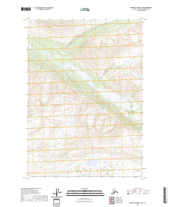
2024 Map of Bering Glacier D-7 NW
USGS Topo · Published 2024About this map
Wrangell-St. Elias Wilderness encompasses the entirety of this interior Alaskan landscape, which remains largely defined by its glacial activity and deep relief. The topography is dominated by the Middle Fork Lobe Bremner Glacier in the southeastern quadrant, where ice and meltwater shape the surrounding terrain. In the northwest, the high ridges are carved by Twelvemile Canyon, a significant geographic feature that cuts through the mountain ranges. This 2024 survey, produced by the U.S. Geological Survey, reflects a region without established roads or settlements, highlighting the purely natural character of the Copper River Census Area at this time. The map provides a precise record of contemporary glacial extent and alpine drainage patterns within one of the nation's most remote wilderness designations.
Find a feature on this map
7 named features on this map. Tap any name to fly to it.
Don’t see what you’re looking for? This feature index may not catch every label — zoom into the map to look around manually.
Map Details
Editions of this 2024 Bering Glacier D-7 NW Map
This is the sole edition of this map. No revisions or reprints were ever made.
Other maps of this area

1950 · McCarthy A-8
USGS Topo · 1:63,360

1950 · Bering Glacier
USGS Topo · 1:250,000

1951 · McCarthy
USGS Topo · 1:250,000

1951 · Bering Glacier
USGS Topo · 1:250,000

1959 · Bering Glacier
USGS Topo · 1:250,000

1959 · McCarthy A-7
USGS Topo · 1:63,360

1960 · McCarthy
USGS Topo · 1:250,000
1984 · Bering Glacier D-7
USGS Topo · 1:63,360
1984 · Bering Glacier D-8
USGS Topo · 1:63,360
2014 · Bering Glacier D-7 NE
USGS Topo · 1:25,000