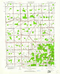
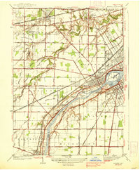
1951 Map of Berkey
USGS Topo · Published 1961About this map
Berkey and Richfield Center anchor this agricultural landscape along the Ohio-Michigan border in the early 1950s. The map illustrates a dense network of country schools that served the rural population, including Mulberry Sch, Tripp Sch, and McCormick Sch. Spiritual and community life is centered at Farley Methodist Church and the Immaculate Conception Sch near Raab Corners. The terrain is defined by an extensive drainage system designed to manage the flat lands of Richfield and Spencer townships, featuring named waterways like Tenmile Creek, Langenderfer Ditch, and Big Oil Ditch. To the southeast, the open landscape transitions toward the wooded tracts of Secor Park, while the Central Golf Course indicates the early suburban development pushing outward from larger nearby centers. This survey captures a moment when small unincorporated crossroads like Frankfort still functioned as local focal points before the expansion of modern infrastructure.
Find a feature on this map
70 named features on this map. Tap any name to fly to it.
Don’t see what you’re looking for? This feature index may not catch every label — zoom into the map to look around manually.
Map Details
Editions of this 1951 Berkey Map
3 editions found
Other maps of this area

1900 · Toledo
USGS Topo · 1:62,500

1911 · Swanton
USGS Topo · 1:62,500

1912 · Dundee
USGS Topo · 1:62,500

1914 · Swanton
USGS Topo · 1:62,500

1926 · Dundee
USGS Topo · 1:62,500

1935 · Whitehouse
USGS Topo · 1:24,000

1935 · Maumee
USGS Topo · 1:24,000

1935 · Berkey
USGS Topo · 1:24,000
1937 · Sylvania
USGS Topo · 1:31,680
1938 · Maumee
USGS Topo · 1:31,680