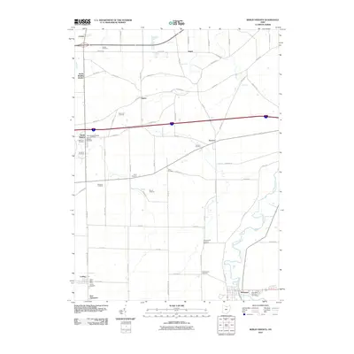
2010 Map of Berlin Heights
USGS Topo · Published 2010About this map
The Vermilion River carves a winding path through this Erie County landscape, where the agricultural legacy of North-Central Ohio is visible in large-scale operations like Burnham Orchards, Quarry Hill Orchards, and Soviak Orchards. The settlement pattern centers on small town hubs like Berlin Heights and Wakeman, with smaller outposts at Florence, Collins, and Ceylon. A notable concentration of family and community burial grounds, including the Denton Farm Cemetery, Peakes Cemetery, and Saint Mary Catholic Cemetery, provides a dense map of local genealogy. The transition from older rail-adjacent sites like Berlin Heights Station to modern road networks is clear, with arterial routes like Main Rd and Darrow Rd connecting the rural farmsteads and orchards that define the township's character.
Find a feature on this map
58 named features on this map. Tap any name to fly to it.
Don’t see what you’re looking for? This feature index may not catch every label — zoom into the map to look around manually.
Map Details
Editions of this 2010 Berlin Heights Map
This is the sole edition of this map. No revisions or reprints were ever made.
Other maps of this area

1903 · Vermilion
USGS Topo · 1:62,500

1904 · Sandusky
USGS Topo · 1:62,500

1908 · New London
USGS Topo · 1:62,500

1915 · Norwalk
USGS Topo · 1:62,500

1944 · Norwalk
USGS Topo · 1:62,500

1956 · Toledo
USGS Topo · 1:250,000

1959 · Milan
USGS Topo · 1:24,000

1959 · Berlin Heights
USGS Topo · 1:24,000

1959 · Vermilion East
USGS Topo · 1:24,000

1959 · Vermilion West
USGS Topo · 1:24,000