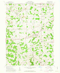
1962 Map of Berlin
USGS Topo · Published 1963About this map
Holmes County’s agricultural heartland is documented here in the early 1960s, showing a landscape defined by small rural settlements and a dense network of country schoolhouses. The Greenville Treaty Line cuts across the northern townships, serving as a persistent historical boundary through Salt Creek and Paint. In the village of Berlin, a central Water Tank stands as a local landmark, while the surrounding area is dotted with family and community institutions such as Hiland High Sch, Troyer Sch, and Chestnut Ridge Sch.
Find a feature on this map
44 named features on this map. Tap any name to fly to it.
Don’t see what you’re looking for? This feature index may not catch every label — zoom into the map to look around manually.
Map Details
Editions of this 1962 Berlin Map
3 editions found

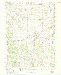
Other maps of this area

1911 · Newcomerstown
USGS Topo · 1:62,500

1913 · Newcomerstown
USGS Topo · 1:62,500

1913 · Coshocton
USGS Topo · 1:62,500

1914 · Navarre
USGS Topo · 1:62,500

1915 · Millersburg
USGS Topo · 1:62,500

1915 · Coshocton
USGS Topo · 1:62,500

1943 · Millersburg
USGS Topo · 1:62,500

1943 · Coshocton
USGS Topo · 1:62,500

1943 · Newcomerstown
USGS Topo · 1:62,500

1944 · Navarre
USGS Topo · 1:62,500