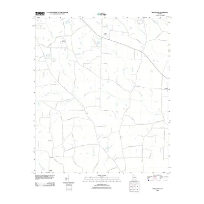
2011 Map of Berlin West
USGS Topo · Published 2011About this map
Okapilco Creek and its many tributaries, including Hog Creek and Little Creek, define this rural section of Colquitt County. The landscape is marked by a network of local roads named for families and early community centers, such as Jerusalem Church Rd and Sardis Church Rd. Small settlements like Berlin and the hamlet of Ione are the primary focal points of the region.
Find a feature on this map
66 named features on this map. Tap any name to fly to it.
Don’t see what you’re looking for? This feature index may not catch every label — zoom into the map to look around manually.
Map Details
Editions of this 2011 Berlin West Map
This is the sole edition of this map. No revisions or reprints were ever made.
Other maps of this area

1953 · Waycross
USGS Topo · 1:250,000

1954 · Valdosta
USGS Topo · 1:250,000

1957 · Thomasville
USGS Topo · 1:62,500

1958 · Valdosta
USGS Topo · 1:250,000

1958 · Waycross
USGS Topo · 1:250,000

1959 · Valdosta
USGS Topo · 1:250,000

1961 · Quitman
USGS Topo · 1:62,500

1974 · Berlin East
USGS Topo · 1:24,000

1974 · Pineboro
USGS Topo · 1:24,000
1974 · Ellenton
USGS Topo · 1:24,000