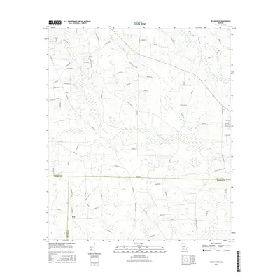
2017 Map of Berlin West
USGS Topo · Published 2017About this map
The agrarian landscape of South Georgia's coastal plain unfolds across the tri-county boundary where Colquitt, Thomas, and Brooks counties meet. The town of Berlin anchors the eastern edge of the survey, while the small community of Ione is located in the southwestern quadrant. This era of rural development is defined by a dense network of county roads and family-named landmarks that trace the local genealogy of the region.
Find a feature on this map
90 named features on this map. Tap any name to fly to it.
Don’t see what you’re looking for? This feature index may not catch every label — zoom into the map to look around manually.
Map Details
Editions of this 2017 Berlin West Map
This is the sole edition of this map. No revisions or reprints were ever made.
Other maps of this area

1953 · Waycross
USGS Topo · 1:250,000

1954 · Valdosta
USGS Topo · 1:250,000

1957 · Thomasville
USGS Topo · 1:62,500

1958 · Valdosta
USGS Topo · 1:250,000

1958 · Waycross
USGS Topo · 1:250,000

1959 · Valdosta
USGS Topo · 1:250,000

1961 · Quitman
USGS Topo · 1:62,500

1974 · Berlin East
USGS Topo · 1:24,000

1974 · Pineboro
USGS Topo · 1:24,000
1974 · Ellenton
USGS Topo · 1:24,000