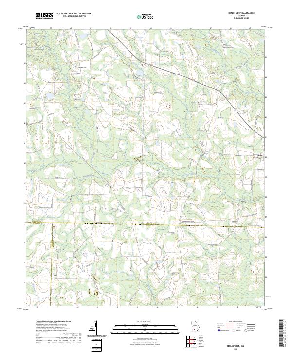
2024 Map of Berlin West
USGS Topo · Published 2024About this map
Indian Creek Primitive Baptist Church and its associated Indian Creek Primitive Baptist Church Cem anchor the northeast corner of this landscape, reflecting the deep-rooted community ties of rural Georgia. This 2024 map documents a largely agricultural region where three county lines—Colquitt, Thomas, and Brooks—converge near several family-named roads and remote burial grounds. The geography is defined by a dendritic network of waterways, including Hog Creek, Okapilco Creek, and Little Creek, which dictate the placement of local thoroughfares.
Find a feature on this map
92 named features on this map. Tap any name to fly to it.
Don’t see what you’re looking for? This feature index may not catch every label — zoom into the map to look around manually.
Map Details
Editions of this 2024 Berlin West Map
This is the sole edition of this map. No revisions or reprints were ever made.
Other maps of this area

1953 · Waycross
USGS Topo · 1:250,000

1954 · Valdosta
USGS Topo · 1:250,000

1957 · Thomasville
USGS Topo · 1:62,500

1958 · Valdosta
USGS Topo · 1:250,000

1958 · Waycross
USGS Topo · 1:250,000

1959 · Valdosta
USGS Topo · 1:250,000

1961 · Quitman
USGS Topo · 1:62,500

1974 · Berlin East
USGS Topo · 1:24,000

1974 · Pineboro
USGS Topo · 1:24,000
1974 · Ellenton
USGS Topo · 1:24,000