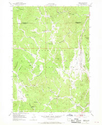
1954 Map of Berne
USGS Topo · Published 1969About this map
The Black Hills National Forest landscape documented in this mid-century survey reveals a transition from mineral extraction to monumental artistry and recreation. Mining history is deeply etched into the hills, with operations like the Crown Mine, Western Star Mine, and the Penobscott Mine scattered among the gulches and peaks. Near the eastern edge, the early stages of the Crazy Horse Carvings on Thunderhead Mountain are noted, marking the beginning of what would become a massive cultural landmark.
Find a feature on this map
45 named features on this map. Tap any name to fly to it.
Don’t see what you’re looking for? This feature index may not catch every label — zoom into the map to look around manually.
Map Details
Editions of this 1954 Berne Map
4 editions found
Other maps of this area

1896 · Harney Peak
USGS Topo · 1:125,000

1901 · Harney Peak
USGS Topo · 1:125,000

1954 · Fourmile
USGS Topo · 1:24,000

1954 · Custer
USGS Topo · 1:24,000

1954 · Hill City
USGS Topo · 1:24,000

1954 · Berne
USGS Topo · 1:24,000

1955 · Jewel Cave
USGS Topo · 1:24,000

1955 · Signal Hill
USGS Topo · 1:24,000
1955 · Cicero Peak
USGS Topo · 1:24,000

1955 · Hot Springs
USGS Topo · 1:250,000