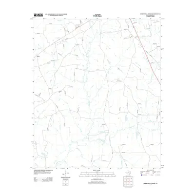
2013 Map of Berryhill Creek
USGS Topo · Published 2013About this map
The Angelina River meanders through the southern reaches of this Rusk County landscape, fed by a dense network of tributaries including Shawnee Cr and Berryhill Cr. This 2013 survey of the area southeast of Henderson reflects a rural character defined by agricultural parcels and thick timber, punctuated by small bodies of water like Eaton Lake and Shelton Lake. The settlement of Hickey appears in the northwest, situated along a junction of county roads and FM 839. For genealogists and local historians, several family-named burial sites are documented across the terrain, notably Davis Cem, Lockridge Cem, and Crow Cem near the northern boundary. The mapping of Sawmill Br and Mill Cr suggests the enduring legacy of early industry and water-powered resource extraction in this part of East Texas.
Find a feature on this map
82 named features on this map. Tap any name to fly to it.
Don’t see what you’re looking for? This feature index may not catch every label — zoom into the map to look around manually.
Map Details
Editions of this 2013 Berryhill Creek Map
This is the sole edition of this map. No revisions or reprints were ever made.
Other maps of this area

1935 · Henderson
USGS Topo · 1:48,000

1939 · Henderson
USGS Topo · 1:62,500

1943 · Cushing
USGS Topo · 1:62,500

1945 · Cushing
USGS Topo · 1:62,500

1953 · Palestine
USGS Topo · 1:250,000

1956 · Tyler
USGS Topo · 1:250,000

1957 · Palestine
USGS Topo · 1:250,000

1960 · Minden
USGS Topo · 1:62,500

1960 · Mount Enterprise
USGS Topo · 1:62,500

1973 · Henderson
USGS Topo · 1:24,000