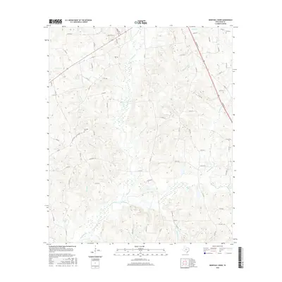
2016 Map of Berryhill Creek
USGS Topo · Published 2016About this map
The Angelina River and its intricate network of tributaries define this pocket of East Texas, where the landscape is carved by waterways like Shawnee Cr and Berryhill Creek. This 2016 survey captures a rural environment structured by its drainage patterns and a dense grid of county roads, such as Co RD 402 W and Co RD 314, which connect isolated homesteads and family tracts. The map provides significant genealogical value through the documentation of local burial sites, including Crow Cem in the northeast and Lockridge Cem further west. Small bodies of water like Eaton Lake and Morris Lake dot the terrain, illustrating the hydrologic character of the Piney Woods region near Henderson. The prevalence of named branches and creeks like Camp Br and Minden Cr suggests a long history of local naming conventions tied to the land's early settlement.
Find a feature on this map
80 named features on this map. Tap any name to fly to it.
Don’t see what you’re looking for? This feature index may not catch every label — zoom into the map to look around manually.
Map Details
Editions of this 2016 Berryhill Creek Map
This is the sole edition of this map. No revisions or reprints were ever made.
Other maps of this area

1935 · Henderson
USGS Topo · 1:48,000

1939 · Henderson
USGS Topo · 1:62,500

1943 · Cushing
USGS Topo · 1:62,500

1945 · Cushing
USGS Topo · 1:62,500

1953 · Palestine
USGS Topo · 1:250,000

1956 · Tyler
USGS Topo · 1:250,000

1957 · Palestine
USGS Topo · 1:250,000

1960 · Minden
USGS Topo · 1:62,500

1960 · Mount Enterprise
USGS Topo · 1:62,500

1973 · Henderson
USGS Topo · 1:24,000