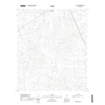
2019 Map of Berryhill Creek
USGS Topo · Published 2019About this map
The Angelina River and its complex network of tributaries define this landscape southeast of Henderson in Rusk County. Wide wetland bottomlands accompany Shawnee Cr and Berryhill Cr, indicating the seasonal flow patterns that have shaped the rural terrain. The map reveals a dispersed settlement pattern tied to the county road system, where family histories are anchored by local landmarks such as Crow Cem, Davis Cem, and Lockridge Cem. These small burial grounds, often tucked away from the main thoroughfares like Railroad St, serve as vital touchstones for genealogical research in East Texas. The southern portion of the area features distinctive local water bodies including Eaton Lake and Shelton Lake, reflecting the well-watered character of the Piney Woods region.
Find a feature on this map
79 named features on this map. Tap any name to fly to it.
Don’t see what you’re looking for? This feature index may not catch every label — zoom into the map to look around manually.
Map Details
Editions of this 2019 Berryhill Creek Map
This is the sole edition of this map. No revisions or reprints were ever made.
Other maps of this area

1935 · Henderson
USGS Topo · 1:48,000

1939 · Henderson
USGS Topo · 1:62,500

1943 · Cushing
USGS Topo · 1:62,500

1945 · Cushing
USGS Topo · 1:62,500

1953 · Palestine
USGS Topo · 1:250,000

1956 · Tyler
USGS Topo · 1:250,000

1957 · Palestine
USGS Topo · 1:250,000

1960 · Minden
USGS Topo · 1:62,500

1960 · Mount Enterprise
USGS Topo · 1:62,500

1973 · Henderson
USGS Topo · 1:24,000