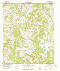
1973 Map of Berryhill Creek
USGS Topo · Published 1977About this map
The rolling piney woods of Rusk County are defined here by a dense network of creek branches and rural sanctuaries. Settlements like Minden and Hickey anchor a landscape dotted with country churches such as Ebenezer Ch and Bethel Ch, serving as community hubs for widely dispersed homesteads. The terrain is deeply etched by water, with Shawnee Creek and Berryhill Creek draining toward the Angelina River in the south.
Find a feature on this map
39 named features on this map. Tap any name to fly to it.
Don’t see what you’re looking for? This feature index may not catch every label — zoom into the map to look around manually.
Map Details
Editions of this 1973 Berryhill Creek Map
This is the sole edition of this map. No revisions or reprints were ever made.
Other maps of this area

1935 · Henderson
USGS Topo · 1:48,000

1939 · Henderson
USGS Topo · 1:62,500

1943 · Cushing
USGS Topo · 1:62,500

1945 · Cushing
USGS Topo · 1:62,500

1953 · Palestine
USGS Topo · 1:250,000

1956 · Tyler
USGS Topo · 1:250,000

1957 · Palestine
USGS Topo · 1:250,000

1960 · Minden
USGS Topo · 1:62,500

1960 · Mount Enterprise
USGS Topo · 1:62,500

1973 · Henderson
USGS Topo · 1:24,000