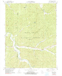
1978 Map of Berryman
USGS Topo · Published 1990About this map
Berryman serves as the central hub of this Missouri landscape, situated within the expansive Mark Twain National Forest. The map details a region defined by its deep hollows and creek systems, where family names and local landmarks trace a history of rural settlement along the border of Crawford and Washington counties. Historically significant sites include the Oak Grove Ch and multiple burial grounds such as Courtois Cem, Dobkins Cem, and Criswell Cem, which provide valuable touchpoints for genealogical research.
Find a feature on this map
33 named features on this map. Tap any name to fly to it.
Don’t see what you’re looking for? This feature index may not catch every label — zoom into the map to look around manually.
Map Details
Editions of this 1978 Berryman Map
4 editions found
Other maps of this area

1901 · De Soto
USGS Topo · 1:125,000

1903 · Sullivan
USGS Topo · 1:125,000

1906 · Potosi
USGS Topo · 1:62,500

1943 · Berryman
USGS Topo · 1:62,500

1945 · Berryman
USGS Topo · 1:62,500

1946 · Richwoods
USGS Topo · 1:62,500

1947 · Sullivan
USGS Topo · 1:62,500

1948 · Richwoods
USGS Topo · 1:62,500

1949 · Saint Louis
USGS Topo · 1:250,000

1949 · Sullivan
USGS Topo · 1:62,500