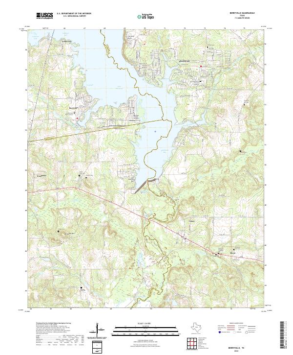
2022 Map of Berryville
USGS Topo · Published 2022About this map
Lake Palestine dominates this landscape, its intricate shoreline forming numerous inlets such as Ledbetter Inlet and Cobb Inlet. The modern development of lakeside communities like Coffee City, Berryville, and Shadybrook contrasts with the surrounding rural terrain, where small settlements such as Cuney and Frankston maintain their traditional character. The map captures a transition from the water-oriented recreation of the north to the more traditional agricultural and timbered lands to the south.
Find a feature on this map
53 named features on this map. Tap any name to fly to it.
Don’t see what you’re looking for? This feature index may not catch every label — zoom into the map to look around manually.
Map Details
Editions of this 2022 Berryville Map
This is the sole edition of this map. No revisions or reprints were ever made.
Other maps of this area

1946 · Bullard
USGS Topo · 1:62,500

1948 · Bullard
USGS Topo · 1:62,500

1949 · Palestine
USGS Topo · 1:62,500

1949 · Frankston
USGS Topo · 1:62,500

1950 · Palestine
USGS Topo · 1:62,500

1950 · Frankston
USGS Topo · 1:62,500

1951 · Jacksonville
USGS Topo · 1:62,500

1953 · Palestine
USGS Topo · 1:250,000

1956 · Tyler
USGS Topo · 1:250,000

1957 · Palestine
USGS Topo · 1:250,000