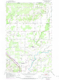
1952 Map of Bertrand Creek
USGS Topo · Published 1974About this map
The international boundary between Canada and the United States defines the northern edge of this landscape, where the agricultural plains of Whatcom County meet British Columbia. The terrain is defined by the drainage patterns of Bertrand Creek and the South Fork Dakota Creek, flowing south toward the winding Nooksack River. Revisions from 1972, shown in purple, illustrate the mid-century development of the area, including the expansion of trailer parks and local infrastructure like the Substation.
Find a feature on this map
56 named features on this map. Tap any name to fly to it.
Don’t see what you’re looking for? This feature index may not catch every label — zoom into the map to look around manually.
Map Details
Editions of this 1952 Bertrand Creek Map
3 editions found
Other maps of this area

1906 · Sumas
USGS Topo · 1:62,500

1907 · Blaine
USGS Topo · 1:62,500

1908 · Sumas
USGS Topo · 1:62,500

1952 · Bertrand Creek
USGS Topo · 1:24,000

1952 · Lynden
USGS Topo · 1:24,000

1952 · Ferndale
USGS Topo · 1:24,000

1952 · Lummi Bay
USGS Topo · 1:24,000

1952 · Blaine
USGS Topo · 1:24,000

1952 · Blaine
USGS Topo · 1:62,500

1954 · Bellingham North
USGS Topo · 1:24,000