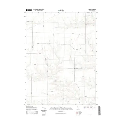
2015 Map of Berwick
USGS Topo · Published 2015About this map
Berwick stands as a central settlement in this portion of Warren County, where a grid of rural routes like 120th Ave and 130th St organizes the agricultural landscape. The area is defined by the drainage patterns of Cedar Cr and Slug Run, which carve through the tillable uplands. For genealogists and local historians, the map preserves the locations of several burial grounds, including Berwick Cem on the edge of town and the more secluded Silent Home Cem to the north near S Henderson Cr. Small clusters of homes and older place-names such as Phelps and Ormonde dot the intersections, reflecting a long-established pattern of midwestern farm life. Further south, the terrain dips toward Negro Cr, while Youngquist Lake provides a rare point of standing water in the eastern section of the quadrangle.
Find a feature on this map
36 named features on this map. Tap any name to fly to it.
Don’t see what you’re looking for? This feature index may not catch every label — zoom into the map to look around manually.
Map Details
Editions of this 2015 Berwick Map
This is the sole edition of this map. No revisions or reprints were ever made.
Other maps of this area

1915 · Avon
USGS Topo · 1:62,500

1916 · Good Hope
USGS Topo · 1:62,500

1918 · Good Hope
USGS Topo · 1:62,500

1921 · Monmouth
USGS Topo · 1:62,500

1923 · Monmouth
USGS Topo · 1:62,500

1925 · Galesburg
USGS Topo · 1:62,500

1927 · Galesburg
USGS Topo · 1:62,500

1944 · Avon
USGS Topo · 1:62,500

1958 · Burlington
USGS Topo · 1:250,000

1961 · Burlington
USGS Topo · 1:250,000