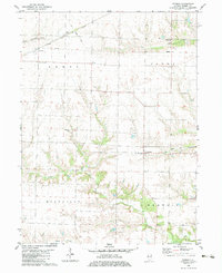
1982 Map of Berwick
USGS Topo · Published 1983About this map
Berwick stands as the primary hub in this agricultural landscape within the townships of Lenox, Floyd, Roseville, and Berwick. The infrastructure of the early 1980s reveals a transition in transportation, marked by the presence of the Atchison Topeka and Santa Fe Railroad Grade in the north and an Old Railroad Grade passing through the village of Berwick. These linear features, alongside various pipeline routes, cut across a terrain drained by Cedar Creek and South Henderson Creek.
Find a feature on this map
17 named features on this map. Tap any name to fly to it.
Don’t see what you’re looking for? This feature index may not catch every label — zoom into the map to look around manually.
Map Details
Editions of this 1982 Berwick Map
This is the sole edition of this map. No revisions or reprints were ever made.
Other maps of this area

1915 · Avon
USGS Topo · 1:62,500

1916 · Good Hope
USGS Topo · 1:62,500

1918 · Good Hope
USGS Topo · 1:62,500

1921 · Monmouth
USGS Topo · 1:62,500

1923 · Monmouth
USGS Topo · 1:62,500

1925 · Galesburg
USGS Topo · 1:62,500

1927 · Galesburg
USGS Topo · 1:62,500

1944 · Avon
USGS Topo · 1:62,500

1958 · Burlington
USGS Topo · 1:250,000

1961 · Burlington
USGS Topo · 1:250,000