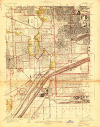
1928 Map of Berwyn
USGS Topo · Published 1928About this map
The Chicago Sanitary and Ship Canal and the parallel Illinois and Michigan Canal dominate the southern landscape of this 1928 survey, illustrating the industrial engine driving Cook County's expansion. This era captures a transition from rural townships to a dense suburban corridor, where the Clearing Industrial District and numerous rail lines like the Indiana Harbor Belt and Belt Ry of Chicago create a massive transportation hub. Unique landmarks of the period include the Maywood U S Mail Airport, highlighting the early days of commercial aviation.
Find a feature on this map
63 named features on this map. Tap any name to fly to it.
Don’t see what you’re looking for? This feature index may not catch every label — zoom into the map to look around manually.
Map Details
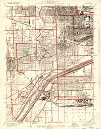
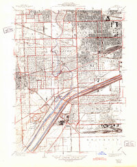
Editions of this 1928 Berwyn Map
3 editions found
Other maps of this area

1889 · Chicago
USGS Topo · 1:62,500

1890 · Des Plaines
USGS Topo · 1:62,500

1891 · Chicago
USGS Topo · 1:62,500

1891 · Riverside
USGS Topo · 1:62,500

1892 · Calumet
USGS Topo · 1:62,500

1893 · Calumet
USGS Topo · 1:62,500

1893 · Riverside
USGS Topo · 1:62,500

1894 · Des Plaines
USGS Topo · 1:62,500

1900 · Chicago
USGS Topo · 1:62,500

1900 · Des Plaines
USGS Topo · 1:62,500