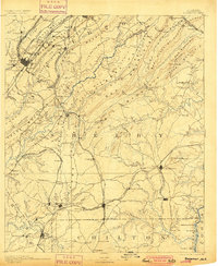
1892 Map of Bessemer
USGS Topo · Published 1900About this map
Jones Valley and Red Mountain define the industrial heart of this late-19th-century survey, where the rapid expansion of the iron and coal industries is evident in the dense network of mineral railroads. The landscape is structured by parallel ridges like Shades Mountain and Oak Mountain, with the Cahaba River winding through the center. Significant industrial activity is centered around Bessemer and the Oxmoor area, where early mining at sites like the Smith Mine fueled the local economy.
Find a feature on this map
162 named features on this map. Tap any name to fly to it.
Don’t see what you’re looking for? This feature index may not catch every label — zoom into the map to look around manually.
Map Details
Editions of this 1892 Bessemer Map
2 editions found
Other maps of this area

1889 · Springville
USGS Topo · 1:125,000

1889 · Birmingham
USGS Topo · 1:125,000

1890 · Bessemer
USGS Topo · 1:125,000

1890 · Talladega
USGS Topo · 1:125,000

1891 · Clanton
USGS Topo · 1:125,000

1892 · Birmingham
USGS Topo · 1:125,000

1892 · Springville
USGS Topo · 1:125,000

1892 · Talladega
USGS Topo · 1:125,000

1892 · Bessemer
USGS Topo · 1:125,000

1893 · Jasper
USGS Topo · 1:125,000