
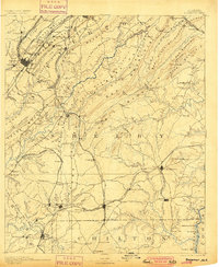
1892 Map of Bessemer
USGS Topo · Published 1892About this map
Birmingham Mineral Railroad and the Alabama Great Southern R.R. converge at Bessemer, anchoring a landscape defined by the extraction and transport of iron ore. The map captures the industrial density of the Red Mountain corridor, where operations like the Smith Mine and furnace sites at Sloss and Woodward appear alongside established communities like Old Jonesboro. The terrain is characterized by the parallel ridges of Oak Mountain and Shades Mountain, which dictate the paths of early travel and commerce.
Find a feature on this map
156 named features on this map. Tap any name to fly to it.
Don’t see what you’re looking for? This feature index may not catch every label — zoom into the map to look around manually.
Map Details
Editions of this 1892 Bessemer Map
2 editions found
Other maps of this area

1889 · Springville
USGS Topo · 1:125,000

1889 · Birmingham
USGS Topo · 1:125,000

1890 · Bessemer
USGS Topo · 1:125,000

1890 · Talladega
USGS Topo · 1:125,000

1891 · Clanton
USGS Topo · 1:125,000

1892 · Birmingham
USGS Topo · 1:125,000

1892 · Springville
USGS Topo · 1:125,000

1892 · Talladega
USGS Topo · 1:125,000

1893 · Jasper
USGS Topo · 1:125,000

1895 · Birmingham
USGS Topo · 1:125,000