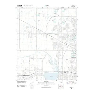
2009 Map of Bethany
USGS Topo · Published 2009About this map
The Bethany area of Oklahoma County is defined by its extensive network of suburban developments and sophisticated water management systems. A series of numbered reservoirs and dams, such as Oknoname 10 Reservoir and the Sedimentation Basin, illustrate the mid-to-late 20th-century hydrological planning required to manage the North Canadian River floodplain. Aviation history is central to the landscape, anchored by the Wiley Post Airport and the Sundance Airpark to the northwest. The presence of numerous memorial grounds, including Resurrection Cemetery and Spring Creek Memorial Cemetery, alongside residential lakeside enclaves like Ski Island Lake and Regal Lake, reveals a community designed for both quiet residence and essential regional transit infrastructure.
Find a feature on this map
74 named features on this map. Tap any name to fly to it.
Don’t see what you’re looking for? This feature index may not catch every label — zoom into the map to look around manually.
Map Details
Editions of this 2009 Bethany Map
This is the sole edition of this map. No revisions or reprints were ever made.
Other maps of this area

1892 · Kingfisher
USGS Topo · 1:125,000

1893 · Oklahoma City
USGS Topo · 1:62,500

1893 · Minco
USGS Topo · 1:62,500

1895 · Kingfisher
USGS Topo · 1:125,000

1904 · Chickasha
USGS Topo · 1:125,000

1951 · Britton
USGS Topo · 1:24,000

1954 · Oklahoma City
USGS Topo · 1:250,000

1956 · Oklahoma City
USGS Topo · 1:24,000

1956 · Oklahoma City
USGS Topo · 1:62,500

1957 · Oklahoma City
USGS Topo · 1:250,000