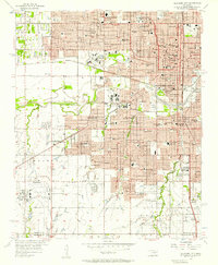
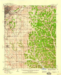
1956 Map of Oklahoma City
USGS Topo · Published 1957About this map
The North Canadian River winds through the heart of the Oklahoma capital during a period of mid-century expansion, separating the dense civic core from the growing southern and western reaches. The cityscape is defined by its institutional strength, from the Oklahoma City University campus and St Anthony Hospital to the sprawling State Fairgrounds. Civic and cultural life centers on the Municipal Auditorium, City Hall, and the Courthouse, while the city’s transit history is clearly visible in the path of the Chicago Rock Island and Pacific railroad and the emerging prominence of the Will Rogers Municipal Airport. Religious and educational heritage is anchored by landmarks like Fairlawn Cemetery and the Sacred Heart Sch, documenting the community’s social fabric just before the peak of suburban sprawl reached the outskirts near Council Grove.
Find a feature on this map
88 named features on this map. Tap any name to fly to it.
Don’t see what you’re looking for? This feature index may not catch every label — zoom into the map to look around manually.
Map Details
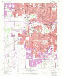
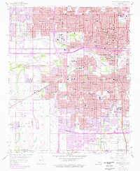
Editions of this 1956 Oklahoma City Map
3 editions found
Other maps of this area

1892 · Moore
USGS Topo · 1:62,500

1892 · Edmond
USGS Topo · 1:62,500

1892 · Kingfisher
USGS Topo · 1:125,000

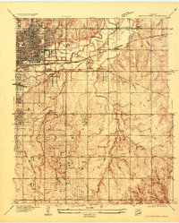
1893 · Oklahoma City
USGS Topo · 1:62,500

1895 · Kingfisher
USGS Topo · 1:125,000

1898 · Purcell
USGS Topo · 1:125,000

1904 · Chickasha
USGS Topo · 1:125,000
1934 · Crutcho Creek
USGS Topo · 1:24,000
1934 · Moore
USGS Topo · 1:62,500
1935 · Spencer
USGS Topo · 1:24,000