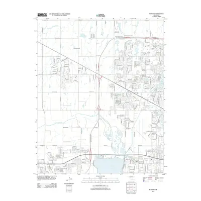
2012 Map of Bethany
USGS Topo · Published 2012About this map
The North Canadian River winds through this suburban landscape northwest of Oklahoma City, defining the transition from established neighborhoods to expanding residential developments. Aviation is central to the area's layout, anchored by the extensive runways of Wiley Post Airport in the southeast and the smaller Sundance Airpark further north. This period shows a community deeply integrated with institutional anchors, including the campus of Southern Nazarene Univ and a high concentration of memorial sites such as Resurrection Cem and Chapel Hill Memorial Gardens.
Find a feature on this map
238 named features on this map. Tap any name to fly to it.
Don’t see what you’re looking for? This feature index may not catch every label — zoom into the map to look around manually.
Map Details
Editions of this 2012 Bethany Map
This is the sole edition of this map. No revisions or reprints were ever made.
Other maps of this area

1892 · Kingfisher
USGS Topo · 1:125,000

1893 · Oklahoma City
USGS Topo · 1:62,500

1893 · Minco
USGS Topo · 1:62,500

1895 · Kingfisher
USGS Topo · 1:125,000

1904 · Chickasha
USGS Topo · 1:125,000

1951 · Britton
USGS Topo · 1:24,000

1954 · Oklahoma City
USGS Topo · 1:250,000

1956 · Oklahoma City
USGS Topo · 1:24,000

1956 · Oklahoma City
USGS Topo · 1:62,500

1957 · Oklahoma City
USGS Topo · 1:250,000