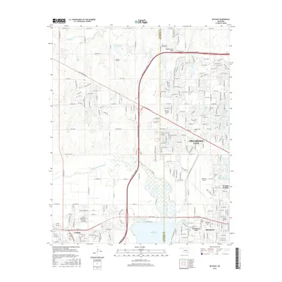
2016 Map of Bethany
USGS Topo · Published 2016About this map
Lake Overholser and the North Canadian River dominate the southwestern quadrant of this 2016 survey, where the suburban expansion of Oklahoma City meets the established communities of Bethany and Warr Acres. The map reveals a densely developed corridor of academic and aviation infrastructure, anchored by Southern Nazarene Univ and Southwestern Christian Univ, alongside the expansive runways of Wiley Post Airport. Northward, the landscape transitions toward the Canadian Co line, characterized by a network of drainage systems like Deer Creek and Bluff Cr Canal. This era is defined by the heavy transit footprint of the John Kilpatrick Turnpike and NW Expressway St, which cut through a region marked by numerous memorial sites including Chapel Hill Memorial Gardens and Resurrection Cem.
Find a feature on this map
143 named features on this map. Tap any name to fly to it.
Don’t see what you’re looking for? This feature index may not catch every label — zoom into the map to look around manually.
Map Details
Editions of this 2016 Bethany Map
This is the sole edition of this map. No revisions or reprints were ever made.
Other maps of this area

1892 · Kingfisher
USGS Topo · 1:125,000

1893 · Oklahoma City
USGS Topo · 1:62,500

1893 · Minco
USGS Topo · 1:62,500

1895 · Kingfisher
USGS Topo · 1:125,000

1904 · Chickasha
USGS Topo · 1:125,000

1951 · Britton
USGS Topo · 1:24,000

1954 · Oklahoma City
USGS Topo · 1:250,000

1956 · Oklahoma City
USGS Topo · 1:24,000

1956 · Oklahoma City
USGS Topo · 1:62,500

1957 · Oklahoma City
USGS Topo · 1:250,000