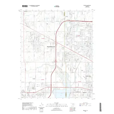
2018 Map of Bethany
USGS Topo · Published 2018About this map
Lake Overholser and the North Canadian River dominate the southern portion of this landscape, marking the transition between the urban expansion of Oklahoma City and its neighboring municipalities. The area is defined by a dense network of suburban development and critical aviation infrastructure, including Wiley Post Airport and Sundance Airport. This 2018 survey reveals the intricate water management system of the region, featuring the Bluff Cr Canal, numerous small lakes like Silver Lake and Eagle Lake, and a series of sedimentation basins. Genealogists will find significant value in the concentration of memorial sites, from the large Chapel Hill Memorial Gardens to smaller grounds such as Bethany Cem and Saint Josephs Cem. The map provides a detailed view of the growing communities of Bethany, Yukon, and Warr Acres, illustrating how these towns have integrated into the greater metropolitan fabric.
Find a feature on this map
112 named features on this map. Tap any name to fly to it.
Don’t see what you’re looking for? This feature index may not catch every label — zoom into the map to look around manually.
Map Details
Editions of this 2018 Bethany Map
This is the sole edition of this map. No revisions or reprints were ever made.
Other maps of this area

1892 · Kingfisher
USGS Topo · 1:125,000

1893 · Oklahoma City
USGS Topo · 1:62,500

1893 · Minco
USGS Topo · 1:62,500

1895 · Kingfisher
USGS Topo · 1:125,000

1904 · Chickasha
USGS Topo · 1:125,000

1951 · Britton
USGS Topo · 1:24,000

1954 · Oklahoma City
USGS Topo · 1:250,000

1956 · Oklahoma City
USGS Topo · 1:24,000

1956 · Oklahoma City
USGS Topo · 1:62,500

1957 · Oklahoma City
USGS Topo · 1:250,000