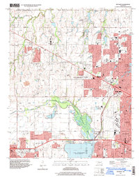
1995 Map of Bethany
USGS Topo · Published 1999About this map
Lake Overholser and the Stinchcomb Wildlife Refuge dominate the central landscape of this mid-1990s survey, showing the transition between suburban development and the riparian environment of the North Canadian River. The map documents the growth of Bethany and Warr Acres, particularly around the Wiley Post Airport and academic centers like Bethany College. Institutional landmarks are prominent, including the St. Francis DeSales Seminary and several regional high schools.
Find a feature on this map
76 named features on this map. Tap any name to fly to it.
Don’t see what you’re looking for? This feature index may not catch every label — zoom into the map to look around manually.
Map Details
Editions of this 1995 Bethany Map
This is the sole edition of this map. No revisions or reprints were ever made.
Other maps of this area

1892 · Kingfisher
USGS Topo · 1:125,000

1893 · Oklahoma City
USGS Topo · 1:62,500

1893 · Minco
USGS Topo · 1:62,500

1895 · Kingfisher
USGS Topo · 1:125,000

1904 · Chickasha
USGS Topo · 1:125,000

1951 · Britton
USGS Topo · 1:24,000

1954 · Oklahoma City
USGS Topo · 1:250,000

1956 · Oklahoma City
USGS Topo · 1:24,000

1956 · Oklahoma City
USGS Topo · 1:62,500

1957 · Oklahoma City
USGS Topo · 1:250,000