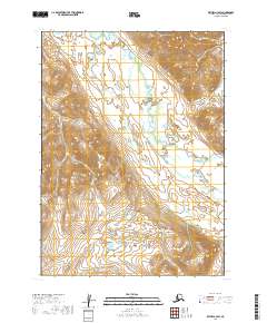
2019 Map of Bethel A-3 SW
USGS Topo · Published 2019About this map
The Tuntut Mountains dominate the southeastern portion of this landscape, rising above a complex drainage system in the Bethel region. The Kwethluk River meanders through the central terrain, acting as a primary artery for the surrounding watershed. This 2019 survey documents a wilderness defined by its water systems, where the Eek River and several smaller tributaries like Kapon Cr, Arsenic Cr, and Fork Cr carve through the high-elevation contours. The map's layout illustrates the transition from high mountain peaks to the alluvial valleys, providing a precise record of the hydrography across the township boundaries of t1s r63w and t1s r62w. It is an essential document for understanding the physical geography of this part of the Alaska interior.
Find a feature on this map
10 named features on this map. Tap any name to fly to it.
Don’t see what you’re looking for? This feature index may not catch every label — zoom into the map to look around manually.
Map Details
Editions of this 2019 Bethel A-3 SW Map
This is the sole edition of this map. No revisions or reprints were ever made.
Other maps of this area

1950 · Bethel
USGS Topo · 1:250,000

1951 · Goodnews
USGS Topo · 1:250,000

1954 · Bethel A-4
USGS Topo · 1:63,360

1954 · Goodnews D-4
USGS Topo · 1:63,360

1979 · Bethel A-3
USGS Topo · 1:63,360

1979 · Goodnews Bay D-3
USGS Topo · 1:63,360

1979 · Goodnews Bay
USGS Topo · 1:250,000

1980 · Bethel
USGS Topo · 1:250,000
2017 · Bethel A-4 NE
USGS Topo · 1:25,000
2017 · Bethel A-4 SE
USGS Topo · 1:25,000