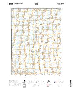
2017 Map of Bethel B-7 SE
USGS Topo · Published 2017About this map
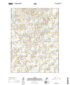
Vast water-dominated terrain defines this portion of the Yukon-Kuskokwim Delta near Bethel, Alaska. The landscape is an intricate network of countless unnamed thaw lakes, ponds, and wetlands that stretch across the boundaries of T3n R70w, T3n R69w, T2n R70w, and T2n R69w. The land surface is nearly level, characterized by a complex of small basins and low-lying marshes. This 2017 survey reflects the remote and sparsely developed character of the region, where the environment is shaped by high-latitude hydrology rather than permanent human settlement. No roads or named structures are present on this sheet, illustrating the untouched nature of the Alaskan wilderness where the Public Land Survey System provides the primary means of geographical orientation.
Find a feature on this map
4 named features on this map. Tap any name to fly to it.
Don’t see what you’re looking for? This feature index may not catch every label — zoom into the map to look around manually.
Map Details
Editions of this 2017 Bethel B-7 SE Map
This is the sole edition of this map. No revisions or reprints were ever made.
Other maps of this area

1950 · Bethel
USGS Topo · 1:250,000

1954 · Bethel B-6
USGS Topo · 1:63,360

1954 · Bethel B-7
USGS Topo · 1:63,360

1954 · Bethel A-7
USGS Topo · 1:63,360

1954 · Bethel A-6
USGS Topo · 1:63,360
1964 · Bethel A-6
USGS Topo · 1:63,360

1980 · Bethel
USGS Topo · 1:250,000
2017 · Bethel A-7 NW
USGS Topo · 1:25,000
2017 · Bethel B-6 SW
USGS Topo · 1:25,000
2017 · Bethel B-7 NE
USGS Topo · 1:25,000