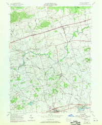
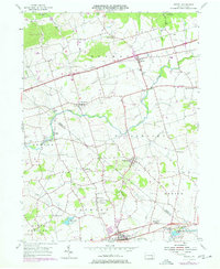
1955 Map of Bethel
USGS Topo · Published 1970About this map
Little Swatara Creek and the Swatara Creek define the drainage of this Pennsylvania landscape, where early industrial and recreational sites dot the countryside between Bethel and Myerstown. The map captures a moment when traditional rural infrastructure, such as the historic Union Canal corridor near Millardsville, existed alongside mid-century developments like the Hilltop Park Speedway and Lebanon Valley Golf Course. Small settlements like Frystown, Rehrersburg, and Mount Aetna are shown with their local landmarks, including Salem Ch and several family-named cemeteries. The intersection of the William Penn 4 Lane Highway and the Benjamin Franklin Highway highlights the era's evolving transportation network, while locations like Camp Greble and Camp Swatara suggest the area's long-standing role as a center for regional youth organizations.
Find a feature on this map
48 named features on this map. Tap any name to fly to it.
Don’t see what you’re looking for? This feature index may not catch every label — zoom into the map to look around manually.
Map Details
Editions of this 1955 Bethel Map
5 editions found
Other maps of this area

1889 · Pottsville
USGS Topo · 1:62,500

1891 · Pottsville
USGS Topo · 1:62,500

1891 · Lebanon
USGS Topo · 1:62,500

1892 · Pine Grove
USGS Topo · 1:62,500

1893 · Lebanon
USGS Topo · 1:62,500

1899 · Lebanon
USGS Topo · 1:62,500

1902 · Wernersville
USGS Topo · 1:62,500

1943 · Lebanon
USGS Topo · 1:62,500

1943 · Wernersville
USGS Topo · 1:62,500

1945 · Friedensburg
USGS Topo · 1:24,000
Featured Places
- Bethel Township, PA
- Myerstown, PA
- Jackson Township, PA
- Millardsville, Jackson Township
- Nacetown, Jackson Township