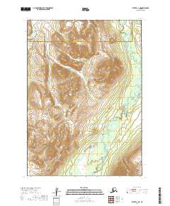
2019 Map of Bethel C-1 NE
USGS Topo · Published 2019About this map
The Aniak River meanders through the eastern portion of this landscape, its winding course defining the lowlands below a series of prominent peaks. In the western reaches, the Kipchuk River cuts through the terrain, with the high ground between these two drainage systems rising to over 2,400 feet. This 2019 survey documents the administrative boundary between the Bethel Census Area and the Dillingham Census Area, which bisects the northern section of the quadrangle. The lack of roads or established settlements emphasizes the remote nature of this part of the Alaska interior, where the topography is dominated by dramatic contour changes and complex river systems that remain the primary geographic landmarks for navigation and land management.
Find a feature on this map
9 named features on this map. Tap any name to fly to it.
Don’t see what you’re looking for? This feature index may not catch every label — zoom into the map to look around manually.
Map Details
Editions of this 2019 Bethel C-1 NE Map
This is the sole edition of this map. No revisions or reprints were ever made.
Other maps of this area

1950 · Bethel
USGS Topo · 1:250,000

1950 · Taylor Mountains
USGS Topo · 1:250,000

1951 · Taylor Mountains
USGS Topo · 1:250,000

1954 · Taylor Mountains
USGS Topo · 1:250,000

1954 · Taylor Mountains D-8
USGS Topo · 1:63,360

1954 · Taylor Mountains C-8
USGS Topo · 1:63,360
1979 · Bethel D-1
USGS Topo · 1:63,360
1979 · Bethel C-1
USGS Topo · 1:63,360

1980 · Bethel
USGS Topo · 1:250,000
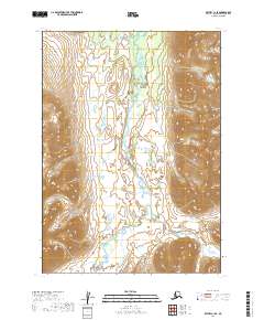
2019 · Bethel C-1 SE
USGS Topo · 1:25,000