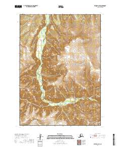
2019 Map of Bethel D-1 SW
USGS Topo · Published 2019About this map
The Kipchuk River defines the drainage pattern of this landscape in the Bethel Census Area, winding through high relief before turning sharply east. This 2019 survey documents the rugged interior terrain where Pass Cr originates, highlighting the complex verticality of the Kuskokwim Mountains region. The map reveals a wild, unpopulated territory, structured primarily by the Public Land Survey System boundaries of t8n r57w and t9n r57w. For those researching this remote portion of Alaska, the map provides precise contour data and hydrographic details that illustrate the natural barriers and seasonal watercourses of the subarctic wilderness.
Find a feature on this map
7 named features on this map. Tap any name to fly to it.
Don’t see what you’re looking for? This feature index may not catch every label — zoom into the map to look around manually.
Map Details
Editions of this 2019 Bethel D-1 SW Map
This is the sole edition of this map. No revisions or reprints were ever made.
Other maps of this area

1950 · Bethel
USGS Topo · 1:250,000

1979 · Bethel D-2
USGS Topo · 1:63,360
1979 · Bethel D-1
USGS Topo · 1:63,360

1979 · Bethel C-2
USGS Topo · 1:63,360
1979 · Bethel C-1
USGS Topo · 1:63,360

1980 · Bethel
USGS Topo · 1:250,000
2019 · Bethel C-2 NE
USGS Topo · 1:25,000
2019 · Bethel D-1 NE
USGS Topo · 1:25,000
2019 · Bethel D-1 SE
USGS Topo · 1:25,000
2019 · Bethel D-2 SE
USGS Topo · 1:25,000