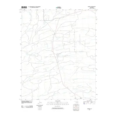
2010 Map of Bethel
USGS Topo · Published 2010About this map
Carter Mountain anchors the southern landscape of this McCurtain County region, overlooking a dense network of drainage basins and local timber routes. The area is defined by its significant water systems, including the East Fork Glover River and Pine Creek, which shape the topography of the Oklahoma backcountry. This 2010 survey illustrates a rural landscape characterized by a sparse road network, where local history is preserved in names like Johnny Beavers Trl and Knox St. The drainage patterns of North Carter Creek, Mud Creek, and Beeman Creek dominate the interior, reflecting a territory where the natural hydrography dictates the placement of roads and crossings. This document provides a record of the land just as modern satellite imagery was becoming the standard for topographic detail.
Find a feature on this map
15 named features on this map. Tap any name to fly to it.
Don’t see what you’re looking for? This feature index may not catch every label — zoom into the map to look around manually.
Map Details
Editions of this 2010 Bethel Map
This is the sole edition of this map. No revisions or reprints were ever made.
Other maps of this area

1902 · Lukfata
USGS Topo · 1:125,000

1950 · Mcalester
USGS Topo · 1:250,000

1959 · Golden
USGS Topo · 1:62,500

1959 · Broken Bow
USGS Topo · 1:62,500

1960 · Bethel
USGS Topo · 1:62,500

1960 · Smithville
USGS Topo · 1:62,500

1962 · McAlester
USGS Topo · 1:250,000

1965 · McAlester
USGS Topo · 1:250,000
1981 · Smithville
USGS Topo · 1:24,000
1981 · Hee Creek
USGS Topo · 1:24,000