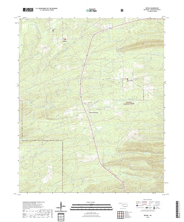
2022 Map of Bethel
USGS Topo · Published 2022About this map
The Ouachita National Forest dominates the terrain of this McCurtain County region, where the E Fork Glover River and its numerous tributaries like Pine Cr and Beeman Cr carve through the foothills. Small settlements are established along the primary routes, notably Bethel, Sherwood, and Mount Herman, each serving as a focal point for the surrounding forest landscape. The topography is defined by significant rises such as Carter Mtn, while the network of forest roads and trails, including Phone Line Trl and Johnny Beavers Trl, indicates the ongoing management and recreational use of the timberlands.
Find a feature on this map
41 named features on this map. Tap any name to fly to it.
Don’t see what you’re looking for? This feature index may not catch every label — zoom into the map to look around manually.
Map Details
Editions of this 2022 Bethel Map
This is the sole edition of this map. No revisions or reprints were ever made.
Other maps of this area

1902 · Lukfata
USGS Topo · 1:125,000

1950 · Mcalester
USGS Topo · 1:250,000

1959 · Golden
USGS Topo · 1:62,500

1959 · Broken Bow
USGS Topo · 1:62,500

1960 · Bethel
USGS Topo · 1:62,500

1960 · Smithville
USGS Topo · 1:62,500

1962 · McAlester
USGS Topo · 1:250,000

1965 · McAlester
USGS Topo · 1:250,000
1981 · Smithville
USGS Topo · 1:24,000
1981 · Hee Creek
USGS Topo · 1:24,000