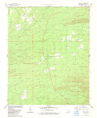
1982 Map of Bethel
USGS Topo · Published 1983About this map
The East Fork Glover River winds through this heavily forested portion of McCurtain County, defining a landscape of high ridges and narrow creek bottoms in the early 1980s. Small rural settlements like Bethel and Sherwood serve as local hubs, while Mt Herman sits tucked along Canyon Creek. The terrain is dominated by prominent elevations including Hee Mountain and Carter Mountain, the latter topped by a Lookout Tower used for forest surveillance. Industrial activity is visible through localized resource extraction at the Shale Pit and Gravel Pit. The map reveals an intricate drainage network where numerous tributaries, such as Little Pine Creek and North Holly Creek, feed into the larger river systems, reflecting the region's complex topography and significance for water resource management.
Find a feature on this map
26 named features on this map. Tap any name to fly to it.
Don’t see what you’re looking for? This feature index may not catch every label — zoom into the map to look around manually.
Map Details
Editions of this 1982 Bethel Map
This is the sole edition of this map. No revisions or reprints were ever made.
Other maps of this area

1902 · Lukfata
USGS Topo · 1:125,000

1950 · Mcalester
USGS Topo · 1:250,000

1959 · Golden
USGS Topo · 1:62,500

1959 · Broken Bow
USGS Topo · 1:62,500

1960 · Bethel
USGS Topo · 1:62,500

1960 · Smithville
USGS Topo · 1:62,500

1962 · McAlester
USGS Topo · 1:250,000

1965 · McAlester
USGS Topo · 1:250,000
1981 · Smithville
USGS Topo · 1:24,000
1981 · Hee Creek
USGS Topo · 1:24,000