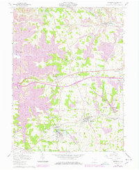
1961 Map of Bethesda
USGS Topo · Published 1978About this map
Bethesda and Belmont anchor the southern half of this Belmont County survey, representing a landscape defined by its ridge-top settlements and the influence of the Baltimore and Ohio railroad. The map captures a moment of transition where traditional small-town life, evidenced by Epworth Park and Union High Sch, coexists with the expanding footprint of the mining industry. Large-scale Strip Mine operations are prominently marked across several townships, particularly in Kirkwood and Union, showing the industrial pressure on the rural landscape.
Find a feature on this map
39 named features on this map. Tap any name to fly to it.
Don’t see what you’re looking for? This feature index may not catch every label — zoom into the map to look around manually.
Map Details
Editions of this 1961 Bethesda Map
3 editions found
Other maps of this area

1903 · Flushing
USGS Topo · 1:62,500

1905 · Clarington
USGS Topo · 1:62,500

1905 · St. Clairsville
USGS Topo · 1:62,500

1905 · Woodsfield
USGS Topo · 1:62,500

1905 · Flushing
USGS Topo · 1:62,500

1935 · Clarington
USGS Topo · 1:62,500

1940 · Clarington
USGS Topo · 1:62,500

1949 · Clarksburg
USGS Topo · 1:250,000

1951 · Canton
USGS Topo · 1:250,000

1953 · Canton
USGS Topo · 1:250,000