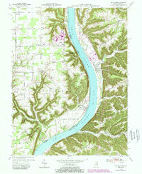
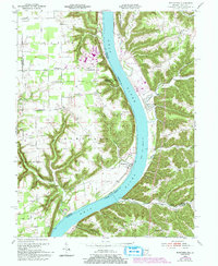
1953 Map of Bethlehem
USGS Topo · Published 1987About this map
The Ohio River cuts a sweeping bend through this mid-century survey, dividing the riverside town of Bethlehem in Indiana from the steep bluffs of Kentucky. The Indiana shore is characterized by a mix of agricultural flats and dissected uplands, where small communities like Otto and Paynesville are connected by a network of rural roads. A significant industrial footprint is visible at Marble Hill, where a large Substation and a facility marked as under construction signal post-war infrastructural development along the river corridor.
Find a feature on this map
49 named features on this map. Tap any name to fly to it.
Don’t see what you’re looking for? This feature index may not catch every label — zoom into the map to look around manually.
Map Details
Editions of this 1953 Bethlehem Map
6 editions found

Other maps of this area

1905 · Prospect
USGS Topo · 1:62,500

1912 · Prospect
USGS Topo · 1:62,500

1932 · La Grange
USGS Topo · 1:62,500

1938 · Owen
USGS Topo · 1:24,000

1939 · Bethlehem
USGS Topo · 1:24,000

1939 · Madison West
USGS Topo · 1:24,000

1948 · Bethlehem
USGS Topo · 1:24,000

1948 · Madison West
USGS Topo · 1:24,000

1948 · Owen
USGS Topo · 1:24,000

1953 · Madison West
USGS Topo · 1:24,000